Framework Plan North and Northern Ring
The framework planning for the closure of the outer ring road and thus, among other things, for the "northern ring road" goes back to the 1930s. The planned road layout of the outer ring road is taken into account by keeping an urban corridor free in various development plans.
General
What is the Northern Ring?
The northern ring road represents the north-western connection of the partly existing outer ring road. It is intended to open up the area of the North Framework Plan between Dinxperloerstraße and Adenauerallee.
Over the course of time, activities in the area of main road construction (outer ring road) have not kept pace with the progressing housing development. At peak traffic times, it can be observed that these roads are reaching the limits of their capacity and the ease and safety of traffic suffers greatly as a result. The development of the urban area and the connection of individual neighbourhoods are severely affected by this. Consequently, the shortcomings are to be counteracted by a change in traffic planning.
Urban development objectives of the planning
- Medium to long-term: realisation of sections of the outer ring road with great traffic urgency up to the closure of the outer ring road
- short to medium term: realisation of sections of the outer ring road with the greatest traffic urgency up to the closure of the outer ring road
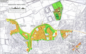
The northern ring road can be divided into the following sections:
- Westring III: Connection to the existing Westring tunnel (L602) up to the junction with Nordring I
- Westring IV: Connection to Dinxperloer Straße, level with Bussardweg to junction with Nordring I
- Nordring I: from the junction with Westring III and Westring IV to Adenauerallee
In addition, there are two further sections to the north-east of the ring closure, entitled Nordring II and III:
- Nordring II: from Adenauerallee to Blücherstraße
- Nordring III: from Blücherstraße to Münsterstraße
(see also overview plan of the sections of the outer ring road; the designations Nordring I-III and Westring II-IV are for clarity, they are not part of the reasons for the plans)
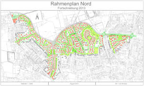
The Nordring therefore serves to close the outer ring road in order to adequately handle the increased volume of traffic. The Nordring I area in particular also serves to develop a new residential area. Urban development concepts for this area have already been developed as part of the development concept for the north of Bocholt, Rahmenplan Nord from 2009, .
All measures are also the subject of the city of Bocholt's mobility concept, which was adopted by the city council on 7 October 2020 and is to be successively implemented over the next few years.
Planning principles
The Münsterland Regional Plan
Münsterland regional plan
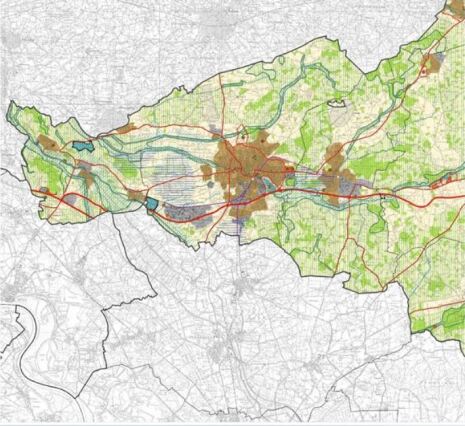
The Münsterland regional plan depicts Bocholt's planned outer ring road as a "significant road". Most of the potential areas for "residential" are located in the north of Bocholt. The development of these areas is therefore directly or indirectly dependent on the "Nordring".
(see also Münsterland regional plan)
The land use plan
The land utilisation plan of the city of Bocholt (FNP)
- Objective: North and West Ring main road with modified routing and residential areas
- The 119th amendment to the F NP between Hemdener Weg and Dinxperloer Straße has been legally effective since 6 March 2023.
Building rights for the main road are to be created by development plan NW 28, which is currently in the process.
Development plans
Following the adoption of the Framework Plan North in 2009 and its update in 2013, a number of urban land-use planning procedures have been initiated. Below you will find an overview of legally binding development plans (bylaws) and ongoing development plan procedures.
Legally binding development plans
Development plan NO 15
- Development plan for internal development in accordance with Section 13a BauGB
- Objective: Nordring between Barloer Weg and Burloer Weg
- Legally binding since 15 February 2013
- Status: The section between Barloer Weg and Burloer Weg has been built and is in operation.
NW 23 Eschkante
- Objective: Creation of residential development area, taking into account the existing tree structures
- Legally binding since 09/03/2023, see planning documents
Current procedure
NW 28 Dinxperloer Straße/Hemdener Weg
- Objective: Realisation of the section of the outer ring road between Hemdener Weg and Dinxperloer Straße
- Early participation takes place from 01.09.2022 to 07.10.2022
- Preparation of the public consultation
10-7/1 Hemdener Weg roundabout
- Objective: Realisation of the section of the outer ring road between Hemdener Weg and Adenauerallee
- Legally binding since 17/03/2025, see planning documents
10-7/2 Hemdener Weg
- Objective: Realisation of the section of the outer ring road between Hemdener Weg and Adenauerallee
- Early participation takes place from 01.09.2022 to 07.10.2022
- Preparation of the public consultation
Framework Plan North
Development concept for Bocholt's north
The Framework Plan North is a development concept for the north of Bocholt.
The Framework Plan North was adopted by the city council on 16 September 2009 as an integrated spatial development concept for the north of Bocholt. In the preceding years, the framework conditions for road traffic in Bocholt had changed fundamentally.
In December 2006, the B67 between the Dingdener Straße junction and Rhede was opened to traffic. At the same time, the B67 was linked to Münsterstraße by the south-east ring road built by the city of Bocholt. In addition, the second construction phase of the Westring between Schwanenstraße and Dinxperloer Straße was opened with the Westring Tunnel. With these extensive construction measures, the city of Bocholt has come a step closer to its goal of closing the outer ring road, which it has been pursuing for decades. The outer ring road is now around two thirds complete.
As a result of these construction measures, road traffic has been reorganised and many roads have been relieved. In particular, Münsterstraße, Uhlandstraße, Westend and the southern section of Dinxperloer Straße should be mentioned here. In the north of Bocholt, on the other hand, it is mainly residential roads through residential and recreational areas that are affected by additional congestion. In 2009, the city council adopted the Framework Plan North.
The North Framework Plan provides for the consolidation of the settlement area in conjunction with the construction of a new northern ring road (north/west ring road) in order to meet the prevailing demand for residential areas and relieve traffic congestion in the city. The relief will have a particularly positive effect on the existing residential areas along Dinxperloer Strasse. Furthermore, a new traffic routing will lead to a better connection to the hospital to the north-east of the change area. This will make it possible to avoid shortcuts, which previously led through the existing residential areas.
Three draft urban development concepts have been developed and weighed up against and among each other in the northern framework plan. The three planning variants were assessed in terms of urban development and utilisation, economic efficiency, traffic, sport and the environment. The urban development concept of variant 3 offered the possibility of more settlement area and at the same time a certain flexibility with regard to the location of the final route of the northern ring road.
In the following years, urban land-use planning procedures were initiated for further sub-areas (west and north ring road area) of the framework plan. This led to certain changes in the settlement structure. This meant that the drafts from the 2013 North Framework Plan had to be updated.


